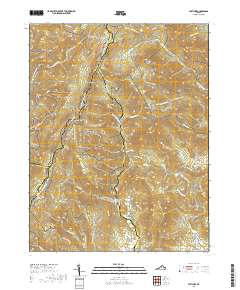
2019 Map of Fletcher
USGS Topo · Published 2019About this map
Shenandoah National Park dominates this portion of the Blue Ridge Mountains, where the high-altitude route of Skyline Dr and the Appalachian National Scenic Trail follow the winding crest of the range. The landscape is defined by steep ridges and deep hollows, with numerous peaks like Fork Mtn and Lewis Mtn providing the headwaters for a complex drainage system. To the east, the Conway River and Rapidan River descend from the heights, carving valleys that have historically supported small mountain communities.
Find a feature on this map
87 named features on this map. Tap any name to fly to it.
Don’t see what you’re looking for? This feature index may not catch every label — zoom into the map to look around manually.
Map Details
Editions of this 2019 Fletcher Map
This is the sole edition of this map. No revisions or reprints were ever made.
Other maps of this area

1892 · Woodstock
USGS Topo · 1:125,000

1892 · Gordonsville
USGS Topo · 1:125,000

1892 · Harrisonburg
USGS Topo · 1:125,000

1893 · Luray
USGS Topo · 1:125,000

1905 · Luray
USGS Topo · 1:125,000

1929 · Stony Man
USGS Topo · 1:48,000

1930 · Madison
USGS Topo · 1:48,000

1933 · Stony Man
USGS Topo · 1:62,500

1933 · Madison
USGS Topo · 1:62,500

1937 · Elkton
USGS Topo · 1:62,500