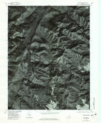
1977 Map of Fletcher
USGS Topo · Published 1981About this map
Bearfence Mountain and the high Blue Ridge terrain dominate this 1977 orthophotoquad, which captures the area surrounding the small settlement of Fletcher. Unlike traditional topographic maps, this aerial imagery provides a direct look at the forest cover and clearing patterns near Upper Pocosin and along the winding Skyline Drive. The drainage network is clearly visible, with the Conway River and Rapidan River carving through the deep valleys. Prominent geological features such as Bear Church Rock and Buzzard Rocks stand out against the wooded slopes, offering a precise visual record of the landscape as it appeared in the late 1970s. This imagery is particularly useful for identifying old road traces and building footprints that are often omitted from stylized line maps.
Find a feature on this map
14 named features on this map. Tap any name to fly to it.
Don’t see what you’re looking for? This feature index may not catch every label — zoom into the map to look around manually.
Map Details
Editions of this 1977 Fletcher Map
This is the sole edition of this map. No revisions or reprints were ever made.
Other maps of this area

1892 · Woodstock
USGS Topo · 1:125,000

1892 · Gordonsville
USGS Topo · 1:125,000

1892 · Harrisonburg
USGS Topo · 1:125,000

1893 · Luray
USGS Topo · 1:125,000

1905 · Luray
USGS Topo · 1:125,000

1929 · Stony Man
USGS Topo · 1:48,000

1930 · Madison
USGS Topo · 1:48,000

1933 · Stony Man
USGS Topo · 1:62,500

1933 · Madison
USGS Topo · 1:62,500

1937 · Elkton
USGS Topo · 1:62,500