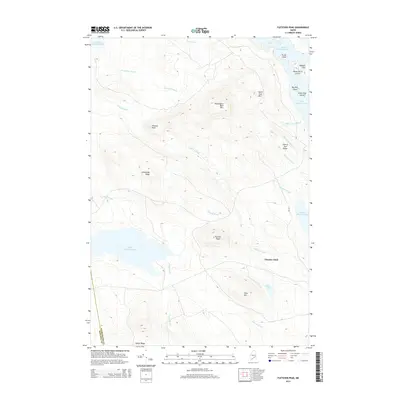
2014 Map of Fletcher Peak
USGS Topo · Published 2014About this map
Washington Bald Mtn and Fletcher Peak dominate this interior landscape along the border of Washington Co and Hancock Co. This portion of Washington County is defined by its extensive water network, where the waters of Fifth Machias Lake flow toward Third Machias Lake and Second Machias Lake through a complex series of drainages including Hadley Brook, Fletcher Brook, and Pennaman Brook. These waterways served as the historic arteries for the region's timber economy, supported by open areas like Fletcher Field.
Find a feature on this map
33 named features on this map. Tap any name to fly to it.
Don’t see what you’re looking for? This feature index may not catch every label — zoom into the map to look around manually.
Map Details
Editions of this 2014 Fletcher Peak Map
This is the sole edition of this map. No revisions or reprints were ever made.
Other maps of this area

1929 · Lead Mountain
USGS Topo · 1:48,000

1932 · Nicatous Lake
USGS Topo · 1:48,000

1932 · Lead Mountain
USGS Topo · 1:62,500

1934 · Nicatous Lake
USGS Topo · 1:62,500

1941 · Tug Mountain
USGS Topo · 1:62,500

1941 · Wabassus Lake
USGS Topo · 1:62,500

1943 · Tug Mountain
USGS Topo · 1:62,500

1943 · Wabassus Lake
USGS Topo · 1:62,500

1948 · Bangor
USGS Topo · 1:250,000

1953 · Wabassus Lake
USGS Topo · 1:62,500