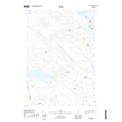
2018 Map of Fletcher Peak
USGS Topo · Published 2018About this map
Fifth Machias Lake and a series of interconnected glacial waters dominate this interior Washington County landscape. The area is characterized by a complex network of brooks and ridges, where Washington Bald Mtn and Farm Cove Mtn rise above the surrounding wetlands. This 2018 survey reveals a terrain defined by its hydrography, with numerous islands like Prune Island and Big Ship Island dotting the larger lakes. The only major road through this timberland is Stud Mill Rd, which crosses the Hancock and Washington county line. The naming of features such as Slewgundy Ridge and Fletcher Field reflects the local nomenclature of the Maine woods, while drainage patterns from Mutton Cove Brook and Hadley Brook illustrate the region's natural watershed boundaries.
Find a feature on this map
36 named features on this map. Tap any name to fly to it.
Don’t see what you’re looking for? This feature index may not catch every label — zoom into the map to look around manually.
Map Details
Editions of this 2018 Fletcher Peak Map
This is the sole edition of this map. No revisions or reprints were ever made.
Other maps of this area

1929 · Lead Mountain
USGS Topo · 1:48,000

1932 · Nicatous Lake
USGS Topo · 1:48,000

1932 · Lead Mountain
USGS Topo · 1:62,500

1934 · Nicatous Lake
USGS Topo · 1:62,500

1941 · Tug Mountain
USGS Topo · 1:62,500

1941 · Wabassus Lake
USGS Topo · 1:62,500

1943 · Tug Mountain
USGS Topo · 1:62,500

1943 · Wabassus Lake
USGS Topo · 1:62,500

1948 · Bangor
USGS Topo · 1:250,000

1953 · Wabassus Lake
USGS Topo · 1:62,500