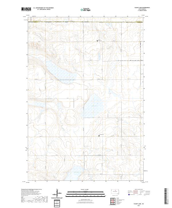
2021 Map of Flight Lake
USGS Topo · Published 2021About this map
The prairie landscape of the Missouri Plateau transitions across the Walworth Co Potter Co border on this recent survey. Defined by a high concentration of ephemeral wetlands and seasonal basins, the area centers on Flight Lake and Green Lake, which serve as primary landmarks in an otherwise open, sectioned terrain. The sparse distribution of human infrastructure is restricted primarily to a grid of county roads and a few enduring community sites that suggest the area's early settlement history.
Find a feature on this map
35 named features on this map. Tap any name to fly to it.
Don’t see what you’re looking for? This feature index may not catch every label — zoom into the map to look around manually.
Map Details
Editions of this 2021 Flight Lake Map
This is the sole edition of this map. No revisions or reprints were ever made.
Other maps of this area

1953 · McIntosh
USGS Topo · 1:250,000

1954 · Aberdeen
USGS Topo · 1:250,000

1956 · Aberdeen
USGS Topo · 1:250,000

1958 · McIntosh
USGS Topo · 1:250,000

1968 · Akaska
USGS Topo · 1:24,000

1970 · Lake Hurley NE
USGS Topo · 1:24,000
1970 · Lake Hurley SE
USGS Topo · 1:24,000

1974 · Lowry
USGS Topo · 1:24,000

1974 · Hoven
USGS Topo · 1:24,000

1974 · Hoven Muni. Airport
USGS Topo · 1:24,000