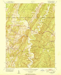
1951 Map of Flintstone
USGS Topo · Published 1951About this map
Flintstone occupies a central valley in the ridge-and-valley landscape of Allegany County, Maryland, just south of the Mason and Dixon Line. This postwar landscape is defined by its series of parallel ridges, including Tussey Mountain, Warrior Mountain, and Polish Mountain, which channel travel along the historic National Pike. The settlement pattern follows the fertile gaps and creek beds, with local life centered around institutions like the Flintstone Creek School and several rural sanctuaries, including Oakdale Ch and Glendale Ch. Numerous named hollows, such as Hardsock Hollow and Possum Hollow, suggest a history of family-centered mountain homesteads. Evidence of early infrastructure persists in the Old Hancock Road and the alignment of a Telephone Line cutting across the high ridges, illustrating how the community adapted to the steep terrain of the Maryland panhandle.
Find a feature on this map
56 named features on this map. Tap any name to fly to it.
Don’t see what you’re looking for? This feature index may not catch every label — zoom into the map to look around manually.
Map Details
Editions of this 1951 Flintstone Map
2 editions found
Other maps of this area

1898 · Paw Paw
USGS Topo · 1:62,500

1899 · Flintstone
USGS Topo · 1:62,500

1900 · Pawpaw
USGS Topo · 1:62,500

1900 · Flintstone
USGS Topo · 1:62,500

1910 · Paw Paw
USGS Topo · 1:62,500

1927 · Clearville
USGS Topo · 1:48,000

1927 · Hyndman
USGS Topo · 1:62,500

1931 · Clearville
USGS Topo · 1:62,500

1931 · Hyndman
USGS Topo · 1:62,500

1944 · Hyndman
USGS Topo · 1:62,500