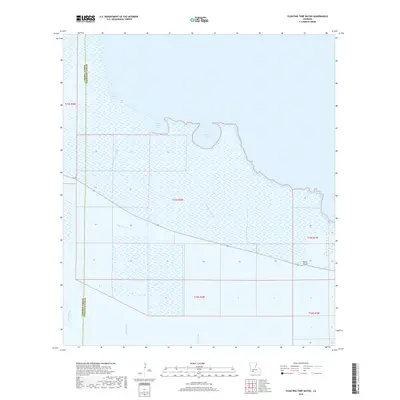
2018 Map of Floating Turf Bayou
USGS Topo · Published 2018About this map
Pecan Island stands as the primary topographical and cultural anchor in this coastal marshland landscape on the border of Cameron Parish and Vermilion Parish. The map reveals a complex hydraulic environment defined by a network of drainage infrastructure and natural waterways, including Big Pecan Ditch and Long Island Ditch, which cut through the wetlands to manage water levels across the chenier. This coastal geography is further shaped by prominent bodies of water such as Alligator Lake, Grande Volle Lake, and Bear Lake, which sit just inland from the gulf-adjacent marshes. The presence of La 82 provides the sole terrestrial artery through this region, connecting the small settlement at Pecan Island to the broader parish. The land is characterized by its tidal influence, with Floating Turf Bayou and Pigeon Bayou meandering through the low-lying reaches, reflecting the transition between stable ridges and the shifting marsh environment.
Find a feature on this map
18 named features on this map. Tap any name to fly to it.
Don’t see what you’re looking for? This feature index may not catch every label — zoom into the map to look around manually.
Map Details
Editions of this 2018 Floating Turf Bayou Map
This is the sole edition of this map. No revisions or reprints were ever made.
Other maps of this area

1932 · Constance Bayou NE
USGS Topo · 1:31,680

1932 · Constance Bayou SW
USGS Topo · 1:31,680

1932 · Pecan Island SW
USGS Topo · 1:31,680

1932 · Constance Bayou SE
USGS Topo · 1:31,680

1932 · Constance Bayou NW
USGS Topo · 1:31,680

1945 · Pecan Island NW
USGS Topo · 1:31,680

1946 · Schooner Bayou SW
USGS Topo · 1:31,680

1951 · Pecan Island
USGS Topo · 1:62,500

1953 · Jacks Point Island
USGS Topo · 1:24,000

1954 · Grand Lake East SE
USGS Topo · 1:31,680