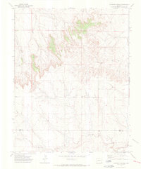
1971 Map of Floating W Ranch
USGS Topo · Published 1973About this map
High plains ranching and remote schoolhouse life characterize this corner of Southeast Colorado in the early 1970s. The landscape is defined by the Floating W Ranch and the isolated Prairie Hill Sch, serving a community scattered among the drainages of Mud Creek and West Clay Creek. The topography reveals a complex network of seasonal watercourses, including Maverick Creek and Little Muddy Creek, which have carved deep draws and distinct overlooks like Prairie Hill and the Bluff.
Find a feature on this map
15 named features on this map. Tap any name to fly to it.
Don’t see what you’re looking for? This feature index may not catch every label — zoom into the map to look around manually.
Map Details
Editions of this 1971 Floating W Ranch Map
2 editions found
Other maps of this area

1892 · Two Butte
USGS Topo · 1:125,000

1893 · Two Butte
USGS Topo · 1:125,000

1955 · La Junta
USGS Topo · 1:250,000

1958 · La Junta
USGS Topo · 1:250,000

1967 · Hand Springs
USGS Topo · 1:24,000

1968 · La Junta
USGS Topo · 1:250,000
1968 · Dripping Spring
USGS Topo · 1:24,000
1968 · Cat Creek
USGS Topo · 1:24,000
1971 · Big Rock Grange
USGS Topo · 1:24,000
1971 · Mc Endree Ranch
USGS Topo · 1:24,000