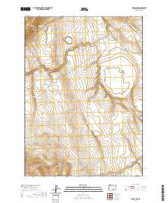
2020 Map of Flook Lake
USGS Topo · Published 2020About this map
Flook Lake dominates this high-desert basin in Lake County, where seasonal waters and springs define the arid landscape. The area is characterized by significant topographical shifts, from the heights of Blizzard Ridge to the deep incisions of Division Canyon and Black Canyon. These canyons, along with Rattlesnake Draw, reveal a drainage system focused on Rock Cr, which winds through the northern sections of the map.
Find a feature on this map
16 named features on this map. Tap any name to fly to it.
Don’t see what you’re looking for? This feature index may not catch every label — zoom into the map to look around manually.
Map Details
Editions of this 2020 Flook Lake Map
This is the sole edition of this map. No revisions or reprints were ever made.
Other maps of this area

1955 · Adel
USGS Topo · 1:250,000

1957 · Adel
USGS Topo · 1:250,000

1958 · Adel
USGS Topo · 1:250,000

1962 · Adel
USGS Topo · 1:250,000

1966 · Bluejoint Lake East
USGS Topo · 1:24,000

1967 · Campbell Lake
USGS Topo · 1:24,000

1967 · Flook Lake
USGS Topo · 1:24,000

1967 · Bluejoint Lake West
USGS Topo · 1:24,000

1967 · Warner Peak
USGS Topo · 1:24,000

1967 · Swede Knoll
USGS Topo · 1:24,000