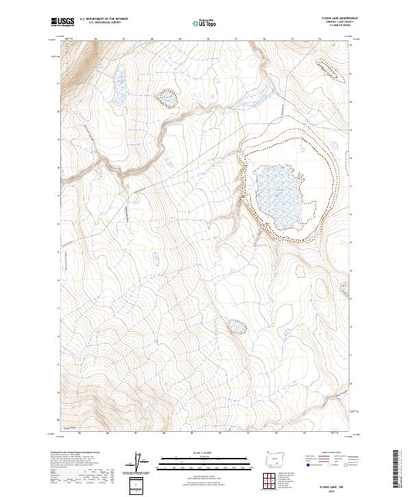
2023 Map of Flook Lake
USGS Topo · Published 2023About this map
The Hart Mountain National Antelope Refuge dominates this section of Lake County, Oregon, revealing a landscape defined by high desert topography and critical water sources. The prominent Poker Jim Ridge and Blizzard Ridge create significant elevation changes, punctuated by the seasonal waters of Flook Lake and Poker Jim Lake. The drainage patterns are clearly visible through features like Rock Creek, Division Canyon, and Rattlesnake Draw, illustrating how water moves across this arid terrain. This 2023 survey provides a clear look at the area's remote character, where the Frenchglen Rd serves as the primary artery through the high country. Map researchers will find precise locations for isolated springs such as Poker Jim Spring and Antelope Spring, which have long been vital landmarks for both wildlife management and early regional travel.
Find a feature on this map
18 named features on this map. Tap any name to fly to it.
Don’t see what you’re looking for? This feature index may not catch every label — zoom into the map to look around manually.
Map Details
Editions of this 2023 Flook Lake Map
This is the sole edition of this map. No revisions or reprints were ever made.
Other maps of this area

1955 · Adel
USGS Topo · 1:250,000

1957 · Adel
USGS Topo · 1:250,000

1958 · Adel
USGS Topo · 1:250,000

1962 · Adel
USGS Topo · 1:250,000

1966 · Bluejoint Lake East
USGS Topo · 1:24,000

1967 · Campbell Lake
USGS Topo · 1:24,000

1967 · Flook Lake
USGS Topo · 1:24,000

1967 · Bluejoint Lake West
USGS Topo · 1:24,000

1967 · Warner Peak
USGS Topo · 1:24,000

1967 · Swede Knoll
USGS Topo · 1:24,000