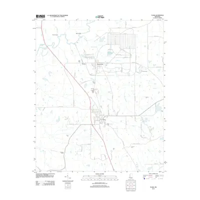
2012 Map of Flora
USGS Topo · Published 2012About this map
The Big Black River forms a winding natural boundary at the northwestern edge of this 2012 survey, shaping a landscape of lowlands and creek drainages in Madison County. The settlement of Flora serves as the central hub, situated near the intersection of local routes and surrounding family cemeteries such as Flora Cem and Fearns Chapel Cem. To the north, the communities of Vernon and Kearney Park appear as residential clusters amidst a patchwork of small lakes and seasonal streams like Balfour Cr and Burnt Corn Cr. Genealogists will find a high density of burial grounds throughout the area, including the Balfour-Gartley Cem and Smith Chapel Cem. Transport and utility are evidenced by local aviation strips like E E Lane Airport and Root Hog Airport, reflecting the rural character of the region as it transitioned into the early 21st century.
Find a feature on this map
107 named features on this map. Tap any name to fly to it.
Don’t see what you’re looking for? This feature index may not catch every label — zoom into the map to look around manually.
Map Details
Editions of this 2012 Flora Map
This is the sole edition of this map. No revisions or reprints were ever made.
Other maps of this area

1903 · Jackson
USGS Topo · 1:125,000

1905 · Jackson
USGS Topo · 1:48,000

1908 · Jackson
USGS Topo · 1:62,500

1934 · Raymond
USGS Topo · 1:48,000

1937 · Raymond
USGS Topo · 1:62,500

1942 · Raymond
USGS Topo · 1:62,500

1955 · Jackson
USGS Topo · 1:250,000

1961 · Jackson
USGS Topo · 1:250,000

1961 · Canton
USGS Topo · 1:62,500

1962 · Jackson
USGS Topo · 1:250,000