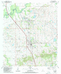
1988 Map of Flora
USGS Topo · Published 1989About this map
The town of Flora serves as the central hub of this late-1980s Madison County landscape, where the agricultural tradition meets emerging development. To the north, the Kearney Park Industrial Area and Kearney Park signal the era's economic shifts, while the surrounding countryside remains anchored by several rural landmarks including the Petrified Forest and multiple family-named burial grounds like Tarpley Cem and Balfour Cem.
Find a feature on this map
38 named features on this map. Tap any name to fly to it.
Don’t see what you’re looking for? This feature index may not catch every label — zoom into the map to look around manually.
Map Details
Editions of this 1988 Flora Map
This is the sole edition of this map. No revisions or reprints were ever made.
Other maps of this area

1903 · Jackson
USGS Topo · 1:125,000

1905 · Jackson
USGS Topo · 1:48,000

1908 · Jackson
USGS Topo · 1:62,500

1934 · Raymond
USGS Topo · 1:48,000

1937 · Raymond
USGS Topo · 1:62,500

1942 · Raymond
USGS Topo · 1:62,500

1955 · Jackson
USGS Topo · 1:250,000

1961 · Jackson
USGS Topo · 1:250,000

1961 · Canton
USGS Topo · 1:62,500

1962 · Jackson
USGS Topo · 1:250,000