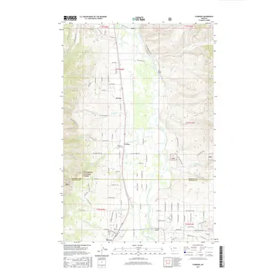
2017 Map of Florence
USGS Topo · Published 2017About this map
The Bitterroot River valley floor transitions from agricultural tracts into the rising eastern slopes of the Bitterroot National Forest in this 2017 survey. The settlement pattern is anchored by Florence and Lolo, with smaller communities like Carlton and McClain situated along the corridor of Old Hwy 93. Genealogists will find the Florence - Carlton Cem and Saint Joseph Cem well-marked near the southern end of the sheet.
Find a feature on this map
103 named features on this map. Tap any name to fly to it.
Don’t see what you’re looking for? This feature index may not catch every label — zoom into the map to look around manually.
Map Details
Editions of this 2017 Florence Map
This is the sole edition of this map. No revisions or reprints were ever made.
Other maps of this area

1903 · Bonner
USGS Topo · 1:125,000

1912 · Missoula
USGS Topo · 1:125,000

1947 · Butte
USGS Topo · 1:250,000

1956 · Hamilton
USGS Topo · 1:250,000

1958 · Butte
USGS Topo · 1:250,000

1959 · Hamilton
USGS Topo · 1:250,000

1959 · Cleveland Mountain
USGS Topo · 1:62,500

1960 · Butte
USGS Topo · 1:250,000

1960 · Hamilton
USGS Topo · 1:250,000

1962 · Butte
USGS Topo · 1:250,000