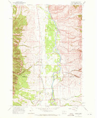
1967 Map of Florence
USGS Topo · Published 1972About this map
The Bitterroot River valley south of Missoula is the focal point of this 1967 survey, where the river's winding channels define the agricultural and residential development of the era. The corridor is anchored by the community of Florence, where local life centered around institutions such as the Florence-Carlton Sch and the Florence-Carlton Community Ch. Transportation and commerce relied heavily on the north-south axis of the Burlington Northern railroad and Route 93, which linked the small settlements of McClain and Carlton to the broader Bitterroot valley. To the west, the terrain rises sharply into the Bitterroot National Forest, carved by numerous drainages like One Horse Creek and Carlton Creek. Unique local landmarks, including the Schreckendgust Landing Strip and Maclay Bridge, illustrate the diverse infrastructure of this rural Montana landscape during the late 1960s.
Find a feature on this map
29 named features on this map. Tap any name to fly to it.
Don’t see what you’re looking for? This feature index may not catch every label — zoom into the map to look around manually.
Map Details
Editions of this 1967 Florence Map
This is the sole edition of this map. No revisions or reprints were ever made.
Other maps of this area

1903 · Bonner
USGS Topo · 1:125,000

1912 · Missoula
USGS Topo · 1:125,000

1947 · Butte
USGS Topo · 1:250,000

1956 · Hamilton
USGS Topo · 1:250,000

1958 · Butte
USGS Topo · 1:250,000

1959 · Hamilton
USGS Topo · 1:250,000

1959 · Cleveland Mountain
USGS Topo · 1:62,500

1960 · Butte
USGS Topo · 1:250,000

1960 · Hamilton
USGS Topo · 1:250,000

1962 · Butte
USGS Topo · 1:250,000