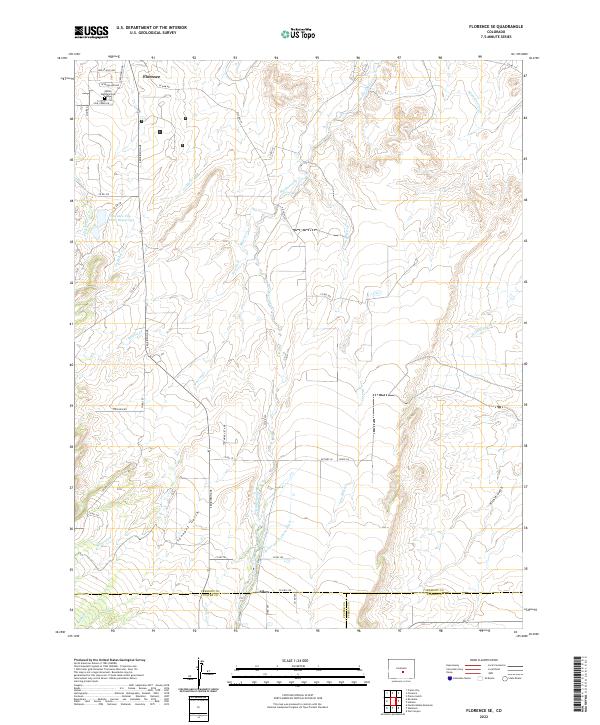
2022 Map of Florence SE
USGS Topo · Published 2022About this map
Florence sits at the northern edge of this high-plains landscape, where the foothills meet the irrigation infrastructure necessary for agriculture in Fremont County. The map details the complex water management systems of the region, including the Minnequa Canal and the Ciperts and Chapson Ditch, which redirect local water sources for industrial and residential use. This 2022 survey traces the varied terrain south of the Arkansas River valley, defined by numerous waterways such as Hardscrabble Cr, Newlin Cr, and Mineral Cr that carve through the landscape towards Tennant Gulch. For those researching local family history, the Union Highland Cem is clearly identified near the northern boundary, while the Florence City Water Reservoirs mark a critical piece of the local utility history. Farther south, the small community of Sikes appears near the border with Custer County, situated along Co HWY 298 and Fourmile Cr.
Find a feature on this map
48 named features on this map. Tap any name to fly to it.
Don’t see what you’re looking for? This feature index may not catch every label — zoom into the map to look around manually.
Map Details
Editions of this 2022 Florence SE Map
This is the sole edition of this map. No revisions or reprints were ever made.
Other maps of this area

1889 · Canon City
USGS Topo · 1:125,000

1891 · Pueblo
USGS Topo · 1:125,000

1892 · Canon City
USGS Topo · 1:125,000

1894 · Pueblo
USGS Topo · 1:125,000

1896 · Pueblo
USGS Topo · 1:125,000

1897 · Pueblo
USGS Topo · 1:125,000

1954 · Pueblo
USGS Topo · 1:250,000

1957 · Pueblo
USGS Topo · 1:250,000

1958 · Pueblo
USGS Topo · 1:250,000

1959 · Florence
USGS Topo · 1:24,000