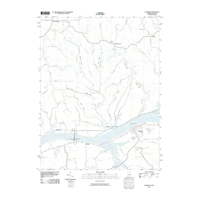
2010 Map of Florence
USGS Topo · Published 2010About this map
Warsaw and Florence sit on opposite banks of the Ohio River, connected by the historical Warsaw and Florence Ferry and anchored by the massive Markland Dam. The terrain is defined by a series of prominent ridges, including McCreary Ridge and Hominy Ridge, where small rural communities like Quercus Grove and Antioch emerged along winding mountain roads. This 2010 survey documents the local transit network and land use at the turn of the decade, showing how the river remains the primary geographic organizer for both Indiana and Kentucky. Genealogists will find notable burial grounds such as Antioch Cemetery and Bark Works Cemetery tucked into the highlands, while the valley floor is shaped by the confluence of Craigs Creek and Log Lick Creek. The map captures a moment when traditional river crossings like the ferry persisted alongside the modern industrial presence of the dam infrastructure.
Find a feature on this map
68 named features on this map. Tap any name to fly to it.
Don’t see what you’re looking for? This feature index may not catch every label — zoom into the map to look around manually.
Map Details
Editions of this 2010 Florence Map
This is the sole edition of this map. No revisions or reprints were ever made.
Other maps of this area

1943 · Florence
USGS Topo · 1:24,000

1943 · Aberdeen
USGS Topo · 1:24,000

1943 · Vevay North
USGS Topo · 1:24,000

1943 · Rising Sun
USGS Topo · 1:24,000

1943 · Patriot
USGS Topo · 1:24,000

1943 · Vevay South
USGS Topo · 1:24,000

1950 · Glencoe
USGS Topo · 1:24,000

1951 · Florence
USGS Topo · 1:24,000

1951 · Rising Sun
USGS Topo · 1:24,000

1951 · Sanders
USGS Topo · 1:24,000