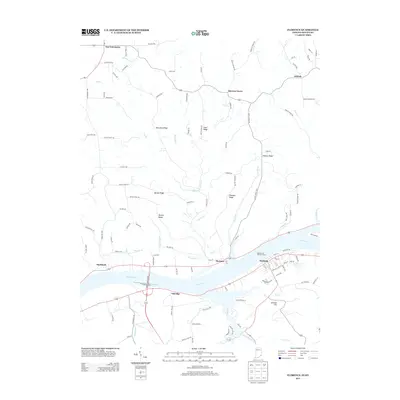
2013 Map of Florence
USGS Topo · Published 2013About this map
The Ohio River carves a deep valley through this borderland between Indiana and Kentucky, anchoring the riverside settlements of Warsaw and Florence. These communities are physically linked by the Florence-Warsaw Brg, a vital connection in a landscape otherwise defined by sharp elevation changes. The terrain north of the river is marked by a series of prominent high points, including McCreary Ridge, Bethel Ridge, and Beatty Ridge, which dictate the winding paths of rural routes like Red Hog Pike and McCrearys Rdg.
Find a feature on this map
114 named features on this map. Tap any name to fly to it.
Don’t see what you’re looking for? This feature index may not catch every label — zoom into the map to look around manually.
Map Details
Editions of this 2013 Florence Map
This is the sole edition of this map. No revisions or reprints were ever made.
Other maps of this area

1943 · Florence
USGS Topo · 1:24,000

1943 · Aberdeen
USGS Topo · 1:24,000

1943 · Vevay North
USGS Topo · 1:24,000

1943 · Rising Sun
USGS Topo · 1:24,000

1943 · Patriot
USGS Topo · 1:24,000

1943 · Vevay South
USGS Topo · 1:24,000

1950 · Glencoe
USGS Topo · 1:24,000

1951 · Florence
USGS Topo · 1:24,000

1951 · Rising Sun
USGS Topo · 1:24,000

1951 · Sanders
USGS Topo · 1:24,000