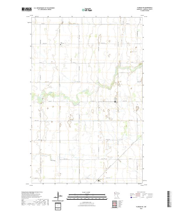
2022 Map of Florian SW
USGS Topo · Published 2022About this map
Middle River meanders across this rural section of Marshall County, defining a landscape of agriculture and small community foundations. The region is marked by its early-20th-century township structure, including t156n r47w and t155n r47w. For genealogists and local historians, the map provides precise locations for several regional burial grounds, such as Saint John's Cem in the north and the clustered Alma Lutheran Cem and Alma Baptist Cem central to the quadrangle. The southern edge is defined by Swift Coulee and McCrea Cem, showing the enduring footprint of rural settlement in the Red River Valley region of northern Minnesota. This modern survey reflects a section-line road system that has remained largely consistent since the original homesteading era.
Find a feature on this map
26 named features on this map. Tap any name to fly to it.
Don’t see what you’re looking for? This feature index may not catch every label — zoom into the map to look around manually.
Map Details
Editions of this 2022 Florian SW Map
This is the sole edition of this map. No revisions or reprints were ever made.
Other maps of this area

1918 · Angus
USGS Topo · 1:62,500

1918 · Argyle
USGS Topo · 1:62,500

1918 · Warren
USGS Topo · 1:62,500

1952 · Thief River Falls
USGS Topo · 1:250,000

1954 · Stephen
USGS Topo · 1:62,500

1955 · Warren
USGS Topo · 1:62,500

1956 · Thief River Falls
USGS Topo · 1:250,000

1956 · Florian
USGS Topo · 1:62,500

1957 · Thief River Falls
USGS Topo · 1:250,000

1961 · Radium
USGS Topo · 1:24,000