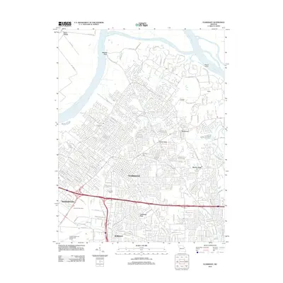
2012 Map of Florissant
USGS Topo · Published 2012About this map
Florissant and the surrounding north St. Louis County suburbs are shown here in a period of dense residential maturity, bounded to the north by the sweeping curves of the Missouri River. The landscape transitions from the heavy suburban grids of Hazelwood and Berkeley in the south to the more topographical and riparian character near Car of Commerce Chute. This survey captures the complex road networks that define these communities, contrasting the busy southern transit corridors near Lambert-Saint Louis International Airport with the quieter, historically named areas like Musicks Ferry and Black Walnut along the riverbanks.
Find a feature on this map
160 named features on this map. Tap any name to fly to it.
Don’t see what you’re looking for? This feature index may not catch every label — zoom into the map to look around manually.
Map Details
Editions of this 2012 Florissant Map
This is the sole edition of this map. No revisions or reprints were ever made.
Other maps of this area

1888 · St. Louis
USGS Topo · 1:62,500

1924 · Robertson
USGS Topo · 1:24,000

1927 · Alton
USGS Topo · 1:62,500

1927 · St. Charles
USGS Topo · 1:62,500

1933 · Creve Coeur
USGS Topo · 1:24,000

1933 · Granite City
USGS Topo · 1:24,000

1933 · Clayton
USGS Topo · 1:24,000

1933 · Saint Charles
USGS Topo · 1:62,500

1934 · Alton
USGS Topo · 1:62,500

1935 · Granite City
USGS Topo · 1:24,000