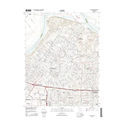
2015 Map of Florissant
USGS Topo · Published 2015About this map
Florissant and the surrounding north St. Louis County suburbs are captured here in a period of dense residential development and established infrastructure. The map transitions from the northern reach of the Missouri River, where Pelican Island sits within the channel, down through historic settlements such as Old Jamestown and Black Jack. This 2015 update documents the contemporary landscape of Hazelwood and Ferguson, showing the expansive footprint of the Lambert-St Louis International Airport in the southwest.
Find a feature on this map
47 named features on this map. Tap any name to fly to it.
Don’t see what you’re looking for? This feature index may not catch every label — zoom into the map to look around manually.
Map Details
Editions of this 2015 Florissant Map
This is the sole edition of this map. No revisions or reprints were ever made.
Other maps of this area

1888 · St. Louis
USGS Topo · 1:62,500

1924 · Robertson
USGS Topo · 1:24,000

1927 · Alton
USGS Topo · 1:62,500

1927 · St. Charles
USGS Topo · 1:62,500

1933 · Creve Coeur
USGS Topo · 1:24,000

1933 · Granite City
USGS Topo · 1:24,000

1933 · Clayton
USGS Topo · 1:24,000

1933 · Saint Charles
USGS Topo · 1:62,500

1934 · Alton
USGS Topo · 1:62,500

1935 · Granite City
USGS Topo · 1:24,000