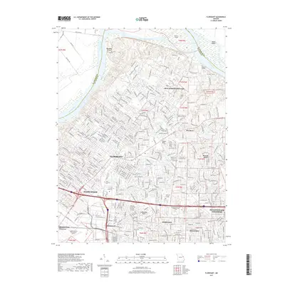
2017 Map of Florissant
USGS Topo · Published 2017About this map
Musicks Ferry marks a point of historic transit where the Missouri River bends along the northern border of St. Louis County. This 2017 survey details a landscape of established suburban density and educational institutions, including the Saint Louis Community College-Florissant Valley and Saint Louis Christian College. The map is particularly useful for genealogists and local historians, as it documents numerous burial sites such as Saint Ferdinand Cem, Sacred Heart Cem, and the historic Cold Water Cem near the Old Jamestown CDP.
Find a feature on this map
376 named features on this map. Tap any name to fly to it.
Don’t see what you’re looking for? This feature index may not catch every label — zoom into the map to look around manually.
Map Details
Editions of this 2017 Florissant Map
This is the sole edition of this map. No revisions or reprints were ever made.
Other maps of this area

1888 · St. Louis
USGS Topo · 1:62,500

1924 · Robertson
USGS Topo · 1:24,000

1927 · Alton
USGS Topo · 1:62,500

1927 · St. Charles
USGS Topo · 1:62,500

1933 · Creve Coeur
USGS Topo · 1:24,000

1933 · Granite City
USGS Topo · 1:24,000

1933 · Clayton
USGS Topo · 1:24,000

1933 · Saint Charles
USGS Topo · 1:62,500

1934 · Alton
USGS Topo · 1:62,500

1935 · Granite City
USGS Topo · 1:24,000