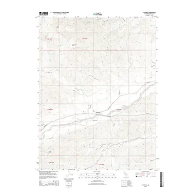
2015 Map of Flournoy
USGS Topo · Published 2015About this map
Flournoy sits as the central hub of this western Tehama County landscape, where the foothills begin their transition toward the Coast Range. The terrain is defined by a network of seasonal and perennial drainages, most notably Thomes Cr and McCarty Cr, which cut through the undulating elevations south of Table Mtn. This 2015 survey reveals a sparse but deliberate road network, including the primary corridor of Paskenta Rd and Corning Rd, connecting remote homesteads and ranch lands. To the north, Government Gulch and Mill Cr carve through the geography, while the southern reaches are marked by Squaw Hollow and the winding path of Houghton Creek. The map documents a contemporary rural California environment where local geography, like McClure Cr and Parker Cr, dictates the placement of long-established property lines and access routes.
Find a feature on this map
36 named features on this map. Tap any name to fly to it.
Don’t see what you’re looking for? This feature index may not catch every label — zoom into the map to look around manually.
Map Details
Editions of this 2015 Flournoy Map
This is the sole edition of this map. No revisions or reprints were ever made.
Other maps of this area

1890 · Red Bluff
USGS Topo · 1:250,000

1894 · Red Bluff
USGS Topo · 1:250,000

1944 · Flournoy
USGS Topo · 1:62,500

1949 · Colyear Springs
USGS Topo · 1:62,500

1951 · West of Gerber
USGS Topo · 1:24,000

1952 · Red Bank
USGS Topo · 1:24,000

1952 · Paskenta
USGS Topo · 1:62,500

1952 · Red Bank
USGS Topo · 1:62,500

1957 · Colyear Springs
USGS Topo · 1:62,500

1957 · Ukiah
USGS Topo · 1:250,000