Loading...
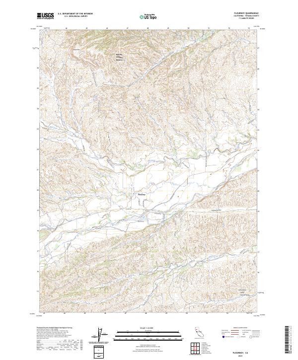
Loading map...2023 Map of Flournoy
USGS Topo · Published 2023About this map
Flournoy sits at the transition where the western foothills meet the broad Sacramento Valley, marked by the confluence of numerous drainage systems. The landscape is defined by the braided paths of Thomes Creek and Mill Creek, which flow eastward from higher elevations like Table Mtn. This modern survey illustrates a network of rural roads such as Corning Rd and Paskenta Rd that connect the settlement of Flournoy to the surrounding ranches and residential developments.
Find a feature on this map
40 named features on this map. Tap any name to fly to it.
Don’t see what you’re looking for? This feature index may not catch every label — zoom into the map to look around manually.
Map Details
Date Portrayed2023
Date Published2023
PublisherU.S. Geological Survey
Map TypeTopographic
Scale1:24000
Physical Dimensions24 x 29 inches
Editions of this 2023 Flournoy Map
This is the sole edition of this map. No revisions or reprints were ever made.
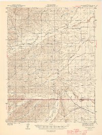
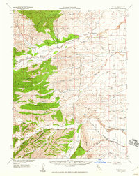
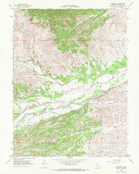
Historical Maps of Rancho Tehama Reserve Through Time
4 maps found
Featured Locations
Source Details
SourceU.S. Geological Survey
CopyrightPublic Domain