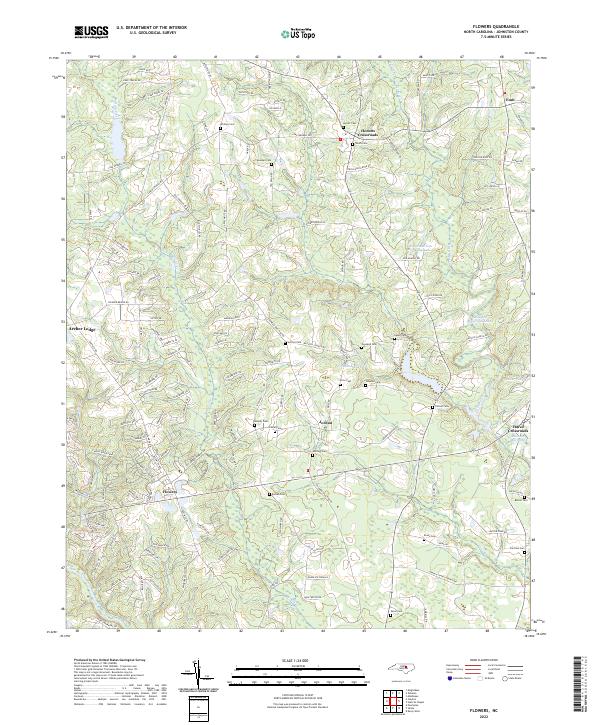
2022 Map of Flowers
USGS Topo · Published 2022About this map
The Neuse River winds through this corner of Johnston County, defining a landscape where rural crossroads and emerging residential pockets meet. Historic nodes like Hocutts Crossroads and Hares Crossroads anchor the eastern side of the sheet, while the growing settlement at Flowers and the established community of Archer Lodge mark the western reaches. The area is dense with family history, evidenced by a high concentration of burial grounds including Whitley Cem, Hocutt Cem, and Woodard Cem, often located near ancestral farmsteads and old routes like Covered Bridge RD.
Find a feature on this map
134 named features on this map. Tap any name to fly to it.
Don’t see what you’re looking for? This feature index may not catch every label — zoom into the map to look around manually.
Map Details
Editions of this 2022 Flowers Map
This is the sole edition of this map. No revisions or reprints were ever made.
Other maps of this area

1902 · Kenly
USGS Topo · 1:62,500

1902 · Spring Hope
USGS Topo · 1:62,500

1903 · Kenly
USGS Topo · 1:62,500

1904 · Springhope
USGS Topo · 1:62,500

1953 · Raleigh
USGS Topo · 1:250,000

1954 · Raleigh
USGS Topo · 1:250,000

1964 · Flowers
USGS Topo · 1:24,000

1964 · Selma
USGS Topo · 1:62,500

1964 · Clayton
USGS Topo · 1:24,000

1964 · Powhatan
USGS Topo · 1:24,000