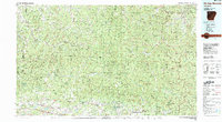
1983 Map of Fly Gap Mountain
USGS Topo · Published 1983About this map
Fly Gap Mountain and the high ridges of the Ozark Mountains dominate this 1983 topographic study, where the headwaters of several major Arkansas river systems originate. The terrain is defined by the protected boundaries of the Ozark National Forest and the Buffalo National River, showcasing a landscape where human settlement is concentrated in narrow valleys and along winding routes like Arkansas 23. Small mountain communities such as Venus, Oark, and Ozone represent the enduring rural character of the region, anchored by local institutions like the Oark Sch and Oark Cem.
Find a feature on this map
63 named features on this map. Tap any name to fly to it.
Don’t see what you’re looking for? This feature index may not catch every label — zoom into the map to look around manually.
Map Details
Editions of this 1983 Fly Gap Mountain Map
This is the sole edition of this map. No revisions or reprints were ever made.
Other maps of this area

1879 · Cravens
USGS Topo · 1:62,500

1879 · Washington
USGS Topo · 1:62,500

1887 · Magazine Mountain #1
USGS Topo · 1:62,500

1887 · Smyrna
USGS Topo · 1:62,500

1887 · Magazine Mountain #2
USGS Topo · 1:62,500

1887 · Watalula
USGS Topo · 1:62,500

1887 · Magazine Mountain
USGS Topo · 1:62,500

1888 · Dardanelle #2
USGS Topo · 1:62,500

1888 · Dardanelle #1
USGS Topo · 1:62,500

1889 · Treat
USGS Topo · 1:62,500