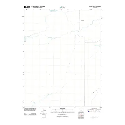
2010 Map of Flying A Ranch
USGS Topo · Published 2010About this map
Flying A Ranch serves as a central landmark in this high plains landscape of Pueblo County, where water management defines the local geography. The area's agricultural and ranching foundations are etched into the terrain through an extensive network of irrigation and storage, including the Nepesta Farmers Ditch, the Dotson and Enlargement Reservoir, and Chicosa Reservoir Number Five. These features, alongside the natural drainage of North Chicosa Creek and Hardesty Draw, illustrate a persistent effort to harness water in an arid environment. The sparse road network, featuring Flying A Rd and Huerfano Meter Station Rd, underscores the scale of these private landholdings. This 2010 survey provides a clear view of the rural infrastructure, from the cattle-country ranching operations to the specific water rights and reservoirs that sustain the region.
Find a feature on this map
12 named features on this map. Tap any name to fly to it.
Don’t see what you’re looking for? This feature index may not catch every label — zoom into the map to look around manually.
Map Details
Editions of this 2010 Flying A Ranch Map
This is the sole edition of this map. No revisions or reprints were ever made.
Other maps of this area

1891 · Nepesta
USGS Topo · 1:125,000

1891 · Apishapa
USGS Topo · 1:125,000

1893 · Nepesta
USGS Topo · 1:125,000

1893 · Apishapa
USGS Topo · 1:125,000

1897 · Apishapa
USGS Topo · 1:125,000

1904 · Nepesta
USGS Topo · 1:125,000

1954 · Trinidad
USGS Topo · 1:250,000

1954 · Pueblo
USGS Topo · 1:250,000

1955 · Trinidad
USGS Topo · 1:250,000

1957 · Pueblo
USGS Topo · 1:250,000