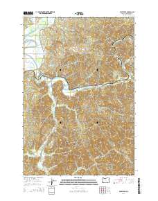
2014 Map of Foley Peak
USGS Topo · Published 2014About this map
Nehalem River and Miami River systems converge in this coastal Oregon landscape, where small river-aligned communities like Wheeler, Mohler, and Foss dot the lowlands. The terrain is defined by steep timberland drainage, centered on Foley Peak and Craig Mtn, which separate the various forks and sloughs. Transportation is deeply tied to the water, with Foss Rd and Miami River Rd following the contours of the valley floors. In the northwest, Gallagher Slough and Fisher Cr mark the transition toward the Nehalem Bay, while inland settlements like Batterson and Barnesdale occupy narrow stretches of flat ground along the river bends. This survey documents the complex network of forest roads, such as Peerless Loop and Fire Break 3 Rd, that provide access to the high ridgelines and remote interior drainages during the early 21st century.
Find a feature on this map
53 named features on this map. Tap any name to fly to it.
Don’t see what you’re looking for? This feature index may not catch every label — zoom into the map to look around manually.
Map Details
Editions of this 2014 Foley Peak Map
This is the sole edition of this map. No revisions or reprints were ever made.
Other maps of this area

1937 · Nehalem
USGS Topo · 1:62,500

1937 · Enright
USGS Topo · 1:62,500

1939 · Saddle Mountain
USGS Topo · 1:62,500

1940 · Cape Falcon
USGS Topo · 1:62,500

1941 · Enright
USGS Topo · 1:62,500

1943 · Nehalem
USGS Topo · 1:62,500

1943 · Saddle Mtn.
USGS Topo · 1:62,500

1948 · Vancouver
USGS Topo · 1:250,000

1950 · Vancouver
USGS Topo · 1:250,000

1950 · Vancouver
USGS Topo · 1:250,000