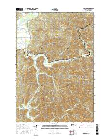
2017 Map of Foley Peak
USGS Topo · Published 2017About this map
The Nehalem River winds through this coastal landscape, creating a distinct valley corridor that supports the small settlements of Wheeler, Mohler, and Foss. The river’s path is flanked by significant elevations, most notably Foley Peak and Craig Mtn, which define the rugged interior topography of Tillamook County. The confluence of the North Fork Nehalem River near the coast highlights a complex wetland system including Gallagher Slough, which has historically shaped the agricultural and transport patterns of the region.
Find a feature on this map
56 named features on this map. Tap any name to fly to it.
Don’t see what you’re looking for? This feature index may not catch every label — zoom into the map to look around manually.
Map Details
Editions of this 2017 Foley Peak Map
This is the sole edition of this map. No revisions or reprints were ever made.
Other maps of this area

1937 · Nehalem
USGS Topo · 1:62,500

1937 · Enright
USGS Topo · 1:62,500

1939 · Saddle Mountain
USGS Topo · 1:62,500

1940 · Cape Falcon
USGS Topo · 1:62,500

1941 · Enright
USGS Topo · 1:62,500

1943 · Nehalem
USGS Topo · 1:62,500

1943 · Saddle Mtn.
USGS Topo · 1:62,500

1948 · Vancouver
USGS Topo · 1:250,000

1950 · Vancouver
USGS Topo · 1:250,000

1950 · Vancouver
USGS Topo · 1:250,000