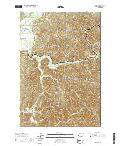
2020 Map of Foley Peak
USGS Topo · Published 2020About this map
The Nehalem River winds through this coastal landscape, passing the small riverfront settlements of Mohler, Foss, and Batterson. In the southwest, the town of Wheeler sits near the river's wider reach and Gallagher Slough, where the waterway begins its transition toward the coast. The terrain is defined by substantial peaks like Foley Peak and Crag Mtn, with a dense network of logging and forest roads such as Miami-River Forest Rd and Anderson Grade Rd carving through the drainages.
Find a feature on this map
60 named features on this map. Tap any name to fly to it.
Don’t see what you’re looking for? This feature index may not catch every label — zoom into the map to look around manually.
Map Details
Editions of this 2020 Foley Peak Map
This is the sole edition of this map. No revisions or reprints were ever made.
Other maps of this area

1937 · Nehalem
USGS Topo · 1:62,500

1937 · Enright
USGS Topo · 1:62,500

1939 · Saddle Mountain
USGS Topo · 1:62,500

1940 · Cape Falcon
USGS Topo · 1:62,500

1941 · Enright
USGS Topo · 1:62,500

1943 · Nehalem
USGS Topo · 1:62,500

1943 · Saddle Mtn.
USGS Topo · 1:62,500

1948 · Vancouver
USGS Topo · 1:250,000

1950 · Vancouver
USGS Topo · 1:250,000

1950 · Vancouver
USGS Topo · 1:250,000