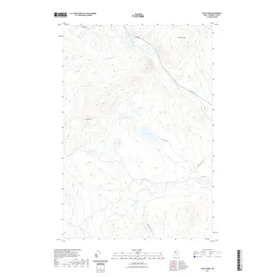
2021 Map of Foley Pond
USGS Topo · Published 2021About this map
The North Branch Penobscot River flows through this Somerset County landscape, anchoring a network of remote waterways and timberland access. In the northern reaches, Comstock Mtn and Green Mtn rise above a series of glacial ponds including Foley Pond and Little Foley Pond. This modern survey illustrates the legacy of the logging industry through its road network, specifically the Golden Rd, which serves as a primary arterial for the region's forest economy. To the south, drainage is defined by Cunningham Brook and Mullen Brook, which feed into several smaller bodies of water such as Cunningham Pond and Fitzgerald Pond. The terrain is characterized by a dense system of brooks, including Spencer Brook and Rattling Brook, that illustrate the intricate hydrology of the Maine North Woods.
Find a feature on this map
23 named features on this map. Tap any name to fly to it.
Don’t see what you’re looking for? This feature index may not catch every label — zoom into the map to look around manually.
Map Details
Editions of this 2021 Foley Pond Map
This is the sole edition of this map. No revisions or reprints were ever made.
Other maps of this area

1949 · Jackman
USGS Topo · 1:250,000

1954 · Seboomook Lake
USGS Topo · 1:62,500

1954 · St. John Pond
USGS Topo · 1:62,500

1954 · Presque Isle
USGS Topo · 1:250,000

1954 · Millinocket
USGS Topo · 1:250,000

1956 · Penobscot Lake
USGS Topo · 1:62,500

1957 · Norris Brook
USGS Topo · 1:62,500

1958 · Presque Isle
USGS Topo · 1:250,000

1958 · Millinocket
USGS Topo · 1:250,000

1958 · Saint John Pond
USGS Topo · 1:62,500
Featured Places
- Pittston Academy Grant, ME
- Comstock Township, ME
- Hammond Township, ME
- Dole Brook Township, ME
- Somerset County, ME