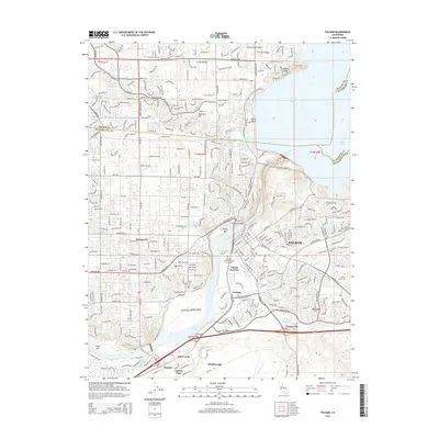
2015 Map of Folsom
USGS Topo · Published 2015About this map
The city of Folsom serves as a central hub in this detailed look at the eastern edge of the Sacramento Valley, where the American River transitions from the deep reservoir of Folsom Lake into the narrow Lake Natoma. The map captures the complex water management infrastructure of the region, including the Folsom South Canal, Natomas Ditch, and Rebel Hill Ditch, alongside landmarks such as the Rainbow Bridge. Substantial residential development in Orangevale and emerging neighborhoods like Glenborough and Easton Place illustrate the suburban expansion south and west of the historic core. Local history is anchored by sites such as the Lakeside Memorial Lawn Cemetery and the geographic point at Negro Bar, while the rail and industrial history of Folsom Junction and Natoma remains visible in the landscape.
Find a feature on this map
52 named features on this map. Tap any name to fly to it.
Don’t see what you’re looking for? This feature index may not catch every label — zoom into the map to look around manually.
Map Details
Editions of this 2015 Folsom Map
This is the sole edition of this map. No revisions or reprints were ever made.
Other maps of this area

1891 · Sacramento
USGS Topo · 1:125,000

1892 · Sacramento
USGS Topo · 1:125,000

1893 · Sacramento
USGS Topo · 1:125,000

1902 · Fairoaks
USGS Topo · 1:62,500

1908 · Buffalo Creek
USGS Topo · 1:31,680

1910 · Roseville
USGS Topo · 1:31,680

1911 · Mills
USGS Topo · 1:31,680

1911 · Antelope
USGS Topo · 1:31,680

1914 · Folsom
USGS Topo · 1:31,680
1916 · Buffalo Creek
USGS Topo · 1:31,680