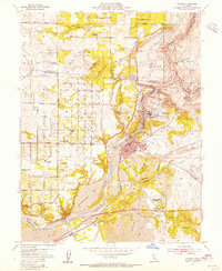
1954 Map of Folsom
USGS Topo · Published 1955About this map
State Prison at Represa PO and the heavy engineering of the Folsom Dam project dominate this mid-century landscape. The survey captures a critical moment of transformation as blue hatching indicates the imminent flooding of the South Fork American River valley to create the Folsom Reservoir. This rising water marks the end of historical sites like Mormon Island, while further downstream, the Nimbus Dam is preparing to form Lake Natoma.
Find a feature on this map
54 named features on this map. Tap any name to fly to it.
Don’t see what you’re looking for? This feature index may not catch every label — zoom into the map to look around manually.
Map Details
Editions of this 1954 Folsom Map
2 editions found
Other maps of this area

1891 · Sacramento
USGS Topo · 1:125,000

1892 · Sacramento
USGS Topo · 1:125,000

1893 · Sacramento
USGS Topo · 1:125,000

1902 · Fairoaks
USGS Topo · 1:62,500

1908 · Buffalo Creek
USGS Topo · 1:31,680

1910 · Roseville
USGS Topo · 1:31,680

1911 · Mills
USGS Topo · 1:31,680

1911 · Antelope
USGS Topo · 1:31,680

1914 · Folsom
USGS Topo · 1:31,680
1916 · Buffalo Creek
USGS Topo · 1:31,680