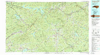
1983 Map of Fontana Lake
USGS Topo · Published 1983About this map
Fontana Lake and the surrounding high country of the Great Smoky Mountains define this 1983 Tennessee Valley Authority compilation. The map captures a landscape shaped by massive hydroelectric projects, including Santeetlah Lake and Nantahala Lake, alongside the extensive Great Smoky Mountains National Park and Nantahala National Forest. It provides a clear view of the Qualla Boundary and the Cherokee Indian Reservation, illustrating the intersection of federal, tribal, and state lands in the early 1980s.
Find a feature on this map
122 named features on this map. Tap any name to fly to it.
Don’t see what you’re looking for? This feature index may not catch every label — zoom into the map to look around manually.
Map Details
Editions of this 1983 Fontana Lake Map
2 editions found
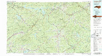
Other maps of this area

1886 · Knoxville
USGS Topo · 1:125,000

1886 · Dahlonega
USGS Topo · 1:125,000

1886 · Walhalla
USGS Topo · 1:125,000

1888 · Ellijay
USGS Topo · 1:125,000

1888 · Pickens
USGS Topo · 1:125,000

1891 · Cowee
USGS Topo · 1:125,000

1892 · Dahlonega
USGS Topo · 1:125,000

1892 · Walhalla
USGS Topo · 1:125,000

1892 · Ellijay
USGS Topo · 1:125,000

1892 · Knoxville
USGS Topo · 1:125,000