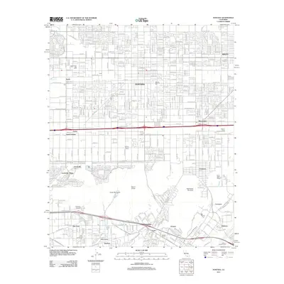
2012 Map of Fontana
USGS Topo · Published 2012About this map
Fontana and Rialto dominate the northern portion of this 2012 survey, illustrating the dense suburban layout and industrial corridors of the Inland Empire. The landscape is marked by a transition from residential grids to the agricultural and logistical hubs of South Fontana and Bloomington. Legacies of the region's ranching history are visible through the Golden Fresh Egg Ranch and Hohberg Poultry Ranch, while the massive Southern Pacific Classification Yards underscore the area's importance as a transportation nexus.
Find a feature on this map
56 named features on this map. Tap any name to fly to it.
Don’t see what you’re looking for? This feature index may not catch every label — zoom into the map to look around manually.
Map Details
Editions of this 2012 Fontana Map
This is the sole edition of this map. No revisions or reprints were ever made.
Other maps of this area

1896 · San Bernardino
USGS Topo · 1:62,500

1897 · Cucamonga
USGS Topo · 1:62,500

1898 · San Bernardino
USGS Topo · 1:62,500

1900 · Cucamonga
USGS Topo · 1:62,500

1901 · Southern California Sheet No. 1
USGS Topo · 1:250,000

1901 · San Bernardino
USGS Topo · 1:62,500

1901 · Elsinore
USGS Topo · 1:125,000

1901 · Riverside
USGS Topo · 1:62,500

1902 · Corona
USGS Topo · 1:125,000

1903 · Cucamonga
USGS Topo · 1:62,500