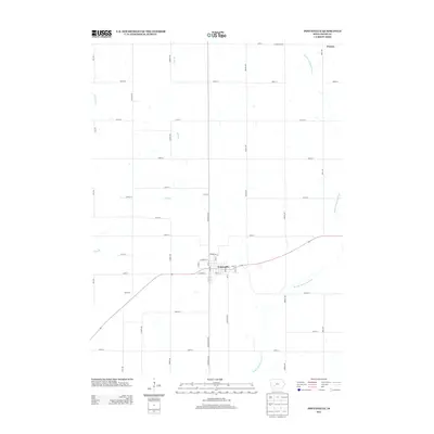
2013 Map of Fontanelle
USGS Topo · Published 2013About this map
Fontanelle serves as the central hub for this portion of Adair County, defined by its traditional grid centered on Main St and Summerset St. The surrounding landscape is characterized by a high-density rural road network, where thoroughfares like Fontanelle Rd and Gibbon Ave intersect to support the agricultural production of the region. This 2013 survey illustrates the enduring township structure in southern Iowa, anchored by the smaller settlement of Prussia to the northeast. Waterways such as the Middle Nodaway River and Rutt Br wind through the sectioned fields, creating the natural drainage patterns that have historically dictated the placement of homesteads and farm infrastructure throughout the quadrangle.
Find a feature on this map
42 named features on this map. Tap any name to fly to it.
Don’t see what you’re looking for? This feature index may not catch every label — zoom into the map to look around manually.
Map Details
Editions of this 2013 Fontanelle Map
This is the sole edition of this map. No revisions or reprints were ever made.
Other maps of this area

1954 · Greenfield
USGS Topo · 1:62,500

1954 · Omaha
USGS Topo · 1:250,000

1957 · Omaha
USGS Topo · 1:250,000

1958 · Omaha
USGS Topo · 1:250,000

1971 · Adair South
USGS Topo · 1:24,000

1971 · Fontanelle
USGS Topo · 1:24,000

1971 · Canby
USGS Topo · 1:24,000

1971 · Fontanelle SW
USGS Topo · 1:24,000

1980 · Nevinville
USGS Topo · 1:24,000

1980 · Bridgewater
USGS Topo · 1:24,000