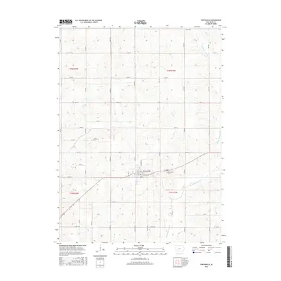
2015 Map of Fontanelle
USGS Topo · Published 2015About this map
Fontanelle sits at the center of this rural Adair County landscape, where the street grid of Main St and Jefferson St meets the agricultural expanse of south-central Iowa. The geography is defined by the winding course of the Middle Nodaway River and its tributary, Rutt Br, which carve gentle patterns through the surrounding township sections. Local heritage is grounded in three distinct burial sites: Prussia Cem to the north, Bryant Cem to the west, and Fontanelle Cem positioned just east of the town limits. The mapping of regional thoroughfares like Co Hwy G49 and Fontanelle Rd illustrates the modern infrastructure connecting these long-standing prairie communities and family farms during the mid-2010s.
Find a feature on this map
39 named features on this map. Tap any name to fly to it.
Don’t see what you’re looking for? This feature index may not catch every label — zoom into the map to look around manually.
Map Details
Editions of this 2015 Fontanelle Map
This is the sole edition of this map. No revisions or reprints were ever made.
Other maps of this area

1954 · Greenfield
USGS Topo · 1:62,500

1954 · Omaha
USGS Topo · 1:250,000

1957 · Omaha
USGS Topo · 1:250,000

1958 · Omaha
USGS Topo · 1:250,000

1971 · Adair South
USGS Topo · 1:24,000

1971 · Fontanelle
USGS Topo · 1:24,000

1971 · Canby
USGS Topo · 1:24,000

1971 · Fontanelle SW
USGS Topo · 1:24,000

1980 · Nevinville
USGS Topo · 1:24,000

1980 · Bridgewater
USGS Topo · 1:24,000