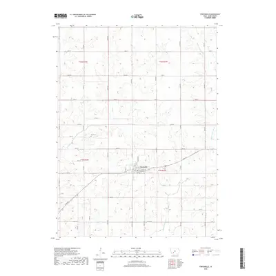
2018 Map of Fontanelle
USGS Topo · Published 2018About this map
Fontanelle serves as the central hub of this Adair County landscape, where a grid of residential streets like Summerset St and Maple St meets the rural agricultural sections. The town's layout is anchored by a traditional downtown core along Main St and Jefferson ST. The surrounding countryside is defined by the winding course of the Middle Nodaway River and its tributaries, including Ninemile Cr and Rutt Br, which carve soft drainage patterns into the prairie. Local history and genealogy are preserved at two distinct burial sites: the large Fontanelle Cem located just south of the town center, and the more remote Bryant Cem positioned to the northwest. This 2018 survey illustrates the enduring intersection of a structured township grid with the natural flow of Iowa's river systems.
Find a feature on this map
43 named features on this map. Tap any name to fly to it.
Don’t see what you’re looking for? This feature index may not catch every label — zoom into the map to look around manually.
Map Details
Editions of this 2018 Fontanelle Map
This is the sole edition of this map. No revisions or reprints were ever made.
Other maps of this area

1954 · Greenfield
USGS Topo · 1:62,500

1954 · Omaha
USGS Topo · 1:250,000

1957 · Omaha
USGS Topo · 1:250,000

1958 · Omaha
USGS Topo · 1:250,000

1971 · Adair South
USGS Topo · 1:24,000

1971 · Fontanelle
USGS Topo · 1:24,000

1971 · Canby
USGS Topo · 1:24,000

1971 · Fontanelle SW
USGS Topo · 1:24,000

1980 · Nevinville
USGS Topo · 1:24,000

1980 · Bridgewater
USGS Topo · 1:24,000