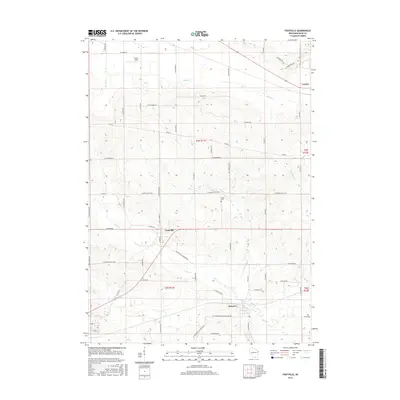
2016 Map of Footville
USGS Topo · Published 2016About this map
Footville and the surrounding agricultural landscape of Rock County are documented here in detail, showing a classic Midwestern township structure. The village of Footville serves as a central hub where N Gilbert St meets the rail line and state highway, while the smaller settlement of Hanover sits further south along Bass Cr. The map reveals a high density of rural roads that follow section lines, such as W Mineral Point Rd and W Townsend Rd, illustrating the orderly land division of the region. Genealogists and local historians will find the location of Grove Cem and various family-named landmarks like Buzzy Field particularly useful for tracing 21st-century property and community boundaries. The drainage of the land is clearly defined by several watercourses including Marsh Cr and Stevens Cr, which navigate the gentle undulations of the terrain north of the Wisconsin-Illinois border area.
Find a feature on this map
62 named features on this map. Tap any name to fly to it.
Don’t see what you’re looking for? This feature index may not catch every label — zoom into the map to look around manually.
Map Details
Editions of this 2016 Footville Map
This is the sole edition of this map. No revisions or reprints were ever made.
Other maps of this area

1889 · Evansville
USGS Topo · 1:62,500

1890 · Stoughton
USGS Topo · 1:62,500

1891 · Janesville
USGS Topo · 1:62,500

1893 · Janesville
USGS Topo · 1:62,500

1893 · Brodhead
USGS Topo · 1:62,500

1894 · Evansville
USGS Topo · 1:62,500

1906 · Evansville
USGS Topo · 1:62,500

1954 · Rockford
USGS Topo · 1:250,000

1955 · Rockford
USGS Topo · 1:250,000

1958 · Rockford
USGS Topo · 1:250,000