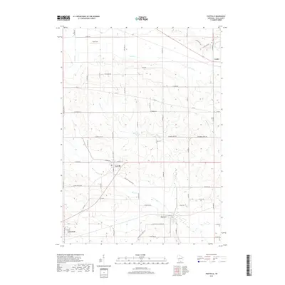
2018 Map of Footville
USGS Topo · Published 2018About this map
Footville and the neighboring settlements of Hanover and Orfordville anchor this southern Wisconsin landscape, where the agricultural grid is defined by a network of long-established county and farm-to-market roads. The drainage pattern is dictated by Bass Cr and Marsh Cr, which wind through the township alongside smaller tributaries like Stevens Cr and Markham Cr. Near the center of the survey, Grove Cem stands as a focal point for local genealogical interest, while the small airfield at Buzzy Field provides a modern landmark among the traditional section lines. Further northeast, the community of Leyden marks a quiet corner of the map near Co Rd A. The layout of local thoroughfares like W Mineral Point Rd and Galena Rd reflects the historic transport routes that have connected these Rock County villages for generations.
Find a feature on this map
61 named features on this map. Tap any name to fly to it.
Don’t see what you’re looking for? This feature index may not catch every label — zoom into the map to look around manually.
Map Details
Editions of this 2018 Footville Map
This is the sole edition of this map. No revisions or reprints were ever made.
Other maps of this area

1889 · Evansville
USGS Topo · 1:62,500

1890 · Stoughton
USGS Topo · 1:62,500

1891 · Janesville
USGS Topo · 1:62,500

1893 · Janesville
USGS Topo · 1:62,500

1893 · Brodhead
USGS Topo · 1:62,500

1894 · Evansville
USGS Topo · 1:62,500

1906 · Evansville
USGS Topo · 1:62,500

1954 · Rockford
USGS Topo · 1:250,000

1955 · Rockford
USGS Topo · 1:250,000

1958 · Rockford
USGS Topo · 1:250,000