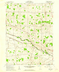
1961 Map of Foraker
USGS Topo · Published 1962About this map
The Scioto River serves as a major cartographic divide on this 1961 sheet, marking the boundary between the Congress Lands to the north and the Virginia Military District to the south. This historical surveying distinction is visible in the shifting orientation of the land lines and field boundaries across the Hardin County landscape. The settlement of Foraker is situated near the Erie Lackawanna Railroad, which parallels the river alongside an old railroad grade, illustrating the corridor's long-standing importance for transportation.
Find a feature on this map
50 named features on this map. Tap any name to fly to it.
Don’t see what you’re looking for? This feature index may not catch every label — zoom into the map to look around manually.
Map Details
Editions of this 1961 Foraker Map
2 editions found
Other maps of this area

1905 · Arlington
USGS Topo · 1:62,500

1907 · Bluffton
USGS Topo · 1:62,500

1907 · Arlington
USGS Topo · 1:24,000

1913 · Alger
USGS Topo · 1:48,000

1915 · Alger
USGS Topo · 1:62,500

1915 · Kenton
USGS Topo · 1:62,500

1943 · Alger
USGS Topo · 1:62,500

1944 · Kenton
USGS Topo · 1:62,500

1950 · Marion
USGS Topo · 1:250,000
1960 · Roundhead
USGS Topo · 1:24,000