
1944 Map of Forbes Island
USGS Topo · Published 1960About this map
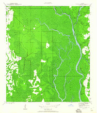
Indian Swamp dominates the western interior of this riverine landscape, where the Apalachicola River snakes along the eastern boundary. The map captures a wartime era defined by the logging industry, evidenced by the Logging RR that penetrates the swamp to reach timber camps like Lister Camp and Kenny Camp. This network of rails and primitive roads, including White City Road, reflects the intensive harvesting of the surrounding Apalachicola National Forest during the mid-1940s.
Find a feature on this map
37 named features on this map. Tap any name to fly to it.
Don’t see what you’re looking for? This feature index may not catch every label — zoom into the map to look around manually.
Map Details
Editions of this 1944 Forbes Island Map
2 editions found
Other maps of this area

1943 · Jackson River
USGS Topo · 1:24,000

1944 · White City
USGS Topo · 1:24,000

1945 · Forbes Island
USGS Topo · 1:31,680

1945 · Lake Wimico
USGS Topo · 1:31,680

1945 · Kennedy Creek
USGS Topo · 1:31,680

1945 · White City
USGS Topo · 1:31,680

1945 · Beverly
USGS Topo · 1:31,680

1945 · Wewahitchka
USGS Topo · 1:31,680

1945 · Jackson River
USGS Topo · 1:31,680

1945 · Fort Gadsden
USGS Topo · 1:31,680