
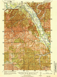
1941 Map of Ford
USGS Topo · Published 1941About this map
The Chehalis River corridor in Grays Harbor County defines this 1941 tactical survey, revealing a landscape deeply integrated with the timber and transit industries of the pre-war era. Extensive rail networks, including the Northern Pacific and its Grays Harbor Branch, parallel the river valley, connecting small settlements like Malone and Cedarville. The presence of the Schafer Logging RR near the confluence with the Satsop River highlights the active logging operations that shaped the local economy. Beyond the floodplain, the topography rises sharply toward Minot Peak, where the dense contour lines indicate the transition from the valley floor to the high ridges of the surrounding forest. Local road networks, including Russell Riding Rd and Norton Road, serve as the primary links for smaller communities like Ford and Lanker, mapping out the rural settlement patterns of early twentieth-century Washington.
Find a feature on this map
25 named features on this map. Tap any name to fly to it.
Don’t see what you’re looking for? This feature index may not catch every label — zoom into the map to look around manually.
Map Details
Editions of this 1941 Ford Map
2 editions found
Other maps of this area

1939 · Shelton
USGS Topo · 1:62,500

1940 · Montesano
USGS Topo · 1:62,500

1941 · Walville
USGS Topo · 1:62,500

1941 · Meskill
USGS Topo · 1:62,500

1941 · Mobray
USGS Topo · 1:62,500

1941 · Gate
USGS Topo · 1:62,500

1943 · Nahwatzel Lake
USGS Topo · 1:62,500

1943 · Mobray
USGS Topo · 1:62,500

1953 · Hoquiam
USGS Topo · 1:250,000

1953 · Rochester
USGS Topo · 1:62,500