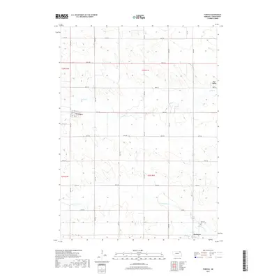
2017 Map of Fordyce
USGS Topo · Published 2017About this map
Fordyce and the outlying settlement of Bow Valley anchor this agricultural landscape in Cedar County. The terrain is defined by a series of drainage systems, most notably W Bow Cr and Norwegian Bow Cr, which carve through the land in an intricate pattern of draws and ridges. A rigid grid of section roads, including 890th RD and 887th RD, provides the primary structure for the rural property boundaries typical of the region's late-twentieth-century development. Genealogists will find the exact locations of the Fordyce Cem on the western edge of town and the Hartington Cem located just north of Hartington. This map captures the transition from small village centers to the larger municipality of Hartington, illustrating the enduring nature of local landmarks and the continuity of the township and range survey system across the Nebraska plains.
Find a feature on this map
25 named features on this map. Tap any name to fly to it.
Don’t see what you’re looking for? This feature index may not catch every label — zoom into the map to look around manually.
Map Details
Editions of this 2017 Fordyce Map
This is the sole edition of this map. No revisions or reprints were ever made.
Other maps of this area

1955 · Sioux City
USGS Topo · 1:250,000

1958 · Sioux City
USGS Topo · 1:250,000

1959 · Sioux City
USGS Topo · 1:250,000

1968 · St. Helena
USGS Topo · 1:24,000

1968 · Coleridge
USGS Topo · 1:24,000

1968 · Hartington
USGS Topo · 1:24,000

1968 · Hartington SW
USGS Topo · 1:24,000

1968 · Gavins Point Dam
USGS Topo · 1:24,000

1968 · Crofton
USGS Topo · 1:24,000

1968 · Wynot
USGS Topo · 1:24,000