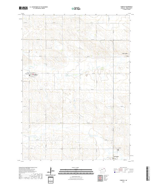
2021 Map of Fordyce
USGS Topo · Published 2021About this map
Fordyce sits at the heart of this Cedar County landscape, where a regular grid of section roads like 558th Ave and 888th Rd defines the agricultural layout of the region. The community center is anchored by the Saint John Baptist Catholic Church and its adjacent Saint John Baptist Catholic Cem, providing a clear focal point for local genealogy and parish history. The terrain is shaped by the winding paths of W Bow Cr and Norwegian Bow Cr, which cut through the steady rise and fall of the Nebraska plains. To the east, the settlement of Bow Valley and the northern outskirts of Hartington appear, including the Hartington Cem. This survey illustrates the enduring rural structure of the Great Plains, where small towns remain connected by a dense network of township roads that have guided travel and property boundaries for generations.
Find a feature on this map
31 named features on this map. Tap any name to fly to it.
Don’t see what you’re looking for? This feature index may not catch every label — zoom into the map to look around manually.
Map Details
Editions of this 2021 Fordyce Map
This is the sole edition of this map. No revisions or reprints were ever made.
Other maps of this area

1955 · Sioux City
USGS Topo · 1:250,000

1958 · Sioux City
USGS Topo · 1:250,000

1959 · Sioux City
USGS Topo · 1:250,000

1968 · St. Helena
USGS Topo · 1:24,000

1968 · Coleridge
USGS Topo · 1:24,000

1968 · Hartington
USGS Topo · 1:24,000

1968 · Hartington SW
USGS Topo · 1:24,000

1968 · Gavins Point Dam
USGS Topo · 1:24,000

1968 · Crofton
USGS Topo · 1:24,000

1968 · Wynot
USGS Topo · 1:24,000