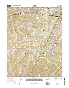
2016 Map of Forest
USGS Topo · Published 2016About this map
Poplar Forest and the expanding residential corridors of Forest dominate this 2016 study of the suburbanizing landscape west of Lynchburg. The map reveals a transition from traditional rural acreage to densely networked subdivisions, particularly around the shores of Timberlake and Wildwood Lake. Despite modern growth, significant markers of local heritage remain, such as the Callaway-Steptoe Cem and the Mount Moriah Cem, which provide anchor points for genealogical research. The terrain is defined by the winding course of Buffalo Cr and Elk Cr, while transportation is anchored by the New London Airport. Smaller settlements like Bellevue and New London show the continued importance of historic road junctions even as new developments like Poplar Forest Lake reshape the watershed of the Big Otter River.
Find a feature on this map
179 named features on this map. Tap any name to fly to it.
Don’t see what you’re looking for? This feature index may not catch every label — zoom into the map to look around manually.
Map Details
Editions of this 2016 Forest Map
This is the sole edition of this map. No revisions or reprints were ever made.
Other maps of this area

1892 · Lynchburg
USGS Topo · 1:125,000

1944 · Lynchburg
USGS Topo · 1:62,500

1947 · Roanoke
USGS Topo · 1:250,000

1950 · Goode
USGS Topo · 1:62,500

1950 · Lynchburg
USGS Topo · 1:62,500

1951 · Altavista
USGS Topo · 1:62,500

1956 · Gladys
USGS Topo · 1:62,500

1959 · Roanoke
USGS Topo · 1:250,000

1963 · Roanoke
USGS Topo · 1:250,000

1963 · City Farm
USGS Topo · 1:24,000