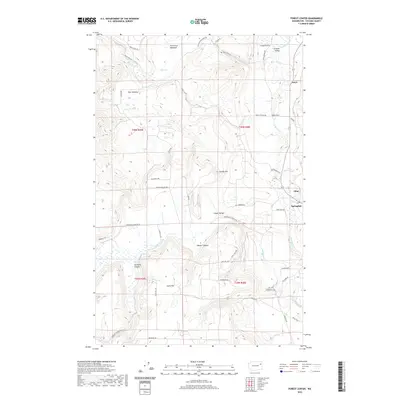
2020 Map of Forest Center
USGS Topo · Published 2020About this map
The Colville Valley and surrounding plateaus are depicted in this 2020 topographic survey, highlighting the agricultural and timber-focused landscape of Stevens County. The town of Springdale serves as the primary hub in the southeastern quadrant, situated near where Sheep Cr and Swamp Cr converge. The terrain is defined by a series of prominent uplands and depressions, including Deer Meadow, Camas Valley, and the expansive Haverland Meadows to the north. These features reflect the glaciated history of the region, where broad valleys are separated by ridges like Lyons Hill and Craney Hill. Smaller settlements and locales such as Grays, Cline, and Forest Center are situated along the valley floor and transportation corridors, connected by a network of rural routes including Deer Creek Rd and Hesseltine Rd.
Find a feature on this map
49 named features on this map. Tap any name to fly to it.
Don’t see what you’re looking for? This feature index may not catch every label — zoom into the map to look around manually.
Map Details
Editions of this 2020 Forest Center Map
This is the sole edition of this map. No revisions or reprints were ever made.
Other maps of this area

1927 · Chewelah
USGS Topo · 1:125,000

1930 · Chewelah
USGS Topo · 1:125,000

1944 · Clayton
USGS Topo · 1:62,500

1944 · Wellpinit
USGS Topo · 1:62,500

1950 · Clayton
USGS Topo · 1:62,500

1953 · Wellpinit
USGS Topo · 1:62,500

1955 · Spokane
USGS Topo · 1:250,000

1958 · Spokane
USGS Topo · 1:250,000

1958 · Sandpoint
USGS Topo · 1:250,000

1963 · Sandpoint
USGS Topo · 1:250,000