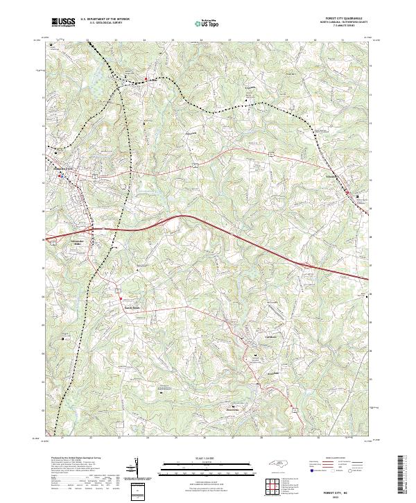
2022 Map of Forest City
USGS Topo · Published 2022About this map
The Second Broad River carves a path through this Rutherford County landscape, anchoring a network of historic mill towns and rural crossroads. The southern portion of the map is defined by the industrial legacy of Caroleen, Avondale, and Henrietta, where the river’s descent provided the essential power for early manufacturing. To the north and west, the terrain transitions into a more traditional agricultural and residential layout, centered on the municipal hubs of Forest City and Bostic. Small family and community landmarks are scattered throughout the hills, including several notable church burial grounds like Corinth Baptist Church Cem and Mount Pleasant Church Cem. This 2022 survey illustrates the modern configuration of these historic piedmont communities, showing how contemporary infrastructure like the Twin Airpark and major road corridors now overlay the older settlement patterns that originally followed the winding Roberson Cr and Buck Br tributaries.
Find a feature on this map
136 named features on this map. Tap any name to fly to it.
Don’t see what you’re looking for? This feature index may not catch every label — zoom into the map to look around manually.
Map Details
Editions of this 2022 Forest City Map
This is the sole edition of this map. No revisions or reprints were ever made.
Other maps of this area

1909 · Gaffney
USGS Topo · 1:62,500

1950 · Shelby
USGS Topo · 1:62,500

1953 · Charlotte
USGS Topo · 1:250,000

1954 · Charlotte
USGS Topo · 1:250,000

1959 · Cowpens
USGS Topo · 1:62,500

1960 · Charlotte
USGS Topo · 1:250,000

1962 · Charlotte
USGS Topo · 1:250,000
1965 · Sunshine
USGS Topo · 1:24,000
1966 · Rutherfordton North
USGS Topo · 1:24,000

1966 · Forest City
USGS Topo · 1:24,000