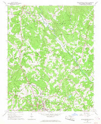
1966 Map of Rutherfordton North
USGS Topo · Published 1968About this map
The Second Broad River cuts a winding path through this portion of Rutherford County, anchoring a landscape of small agricultural settlements and rural congregations. The northern reaches of Rutherfordton and the neighboring industrial community of Spindale show a concentrated pattern of growth, while smaller hamlets like Union Mills and Gilkey remain centered around local landmarks and crossroads. This mid-1960s survey preserves the locations of numerous historic institutions, including the Round Hill Sch and Alexander Sch, along with many family-named churches such as Mitchell Chapel and Owens Chapel. The Southern Railway and the winding course of Catheys Creek provided the primary transport and drainage corridors that shaped the distribution of homesteads. Genealogists will find significant value in the detailed mapping of remote burying grounds like Liberty Hill Cem and the Oak Springs Cem.
Find a feature on this map
62 named features on this map. Tap any name to fly to it.
Don’t see what you’re looking for? This feature index may not catch every label — zoom into the map to look around manually.
Map Details
Editions of this 1966 Rutherfordton North Map
This is the sole edition of this map. No revisions or reprints were ever made.
Other maps of this area

1900 · Mount Mitchell
USGS Topo · 1:125,000

1902 · Mount Mitchell
USGS Topo · 1:125,000

1905 · Morganton
USGS Topo · 1:125,000

1907 · Saluda
USGS Topo · 1:125,000

1953 · Charlotte
USGS Topo · 1:250,000

1954 · Charlotte
USGS Topo · 1:250,000

1955 · Knoxville
USGS Topo · 1:250,000

1957 · Knoxville
USGS Topo · 1:250,000

1959 · Lake Lure
USGS Topo · 1:62,500

1960 · Knoxville
USGS Topo · 1:250,000