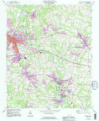
1993 Map of Forest City
USGS Topo · Published 1996About this map
The Second Broad River cuts a winding path through this corner of Rutherford County, anchoring a series of industrial and residential nodes during the late twentieth century. In Forest City, the street grid centers on Main St and Trade St, reflecting a well-established commercial core. Industrial heritage is evident at Alexander Mills and the cluster of Caroleen, Avondale, and Henrietta to the south, where textile roots and riverside development shaped the local economy.
Find a feature on this map
88 named features on this map. Tap any name to fly to it.
Don’t see what you’re looking for? This feature index may not catch every label — zoom into the map to look around manually.
Map Details
Editions of this 1993 Forest City Map
This is the sole edition of this map. No revisions or reprints were ever made.
Other maps of this area

1909 · Gaffney
USGS Topo · 1:62,500

1950 · Shelby
USGS Topo · 1:62,500

1953 · Charlotte
USGS Topo · 1:250,000

1954 · Charlotte
USGS Topo · 1:250,000

1959 · Cowpens
USGS Topo · 1:62,500

1960 · Charlotte
USGS Topo · 1:250,000

1962 · Charlotte
USGS Topo · 1:250,000
1965 · Sunshine
USGS Topo · 1:24,000
1966 · Rutherfordton North
USGS Topo · 1:24,000

1966 · Forest City
USGS Topo · 1:24,000