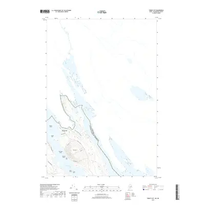
2018 Map of Forest City
USGS Topo · Published 2018About this map
The settlement of Forest City straddles the international boundary on this 2018 survey, positioned at the critical waterway connection between Grand Lake The Arm and Spednic Lake. The landscape is defined by its complex shoreline and island-dotted waters, including Partridge Island, Treasure Island, and Moon Island. The terrain rises sharply at Walls Hill, which overlooks the surrounding lake system and local roads such as Walls Rd and Forest City Rd.
Find a feature on this map
21 named features on this map. Tap any name to fly to it.
Don’t see what you’re looking for? This feature index may not catch every label — zoom into the map to look around manually.
Map Details
Editions of this 2018 Forest City Map
This is the sole edition of this map. No revisions or reprints were ever made.
Other maps of this area

1940 · Danforth
USGS Topo · 1:62,500

1940 · Amity
USGS Topo · 1:62,500

1940 · Forest
USGS Topo · 1:62,500

1941 · Danforth
USGS Topo · 1:62,500

1941 · Amity
USGS Topo · 1:62,500

1942 · Forest
USGS Topo · 1:62,500

1943 · Danforth
USGS Topo · 1:62,500

1943 · Amity
USGS Topo · 1:62,500

1957 · Fredericton
USGS Topo · 1:250,000
1958 · Danforth
USGS Topo · 1:62,500